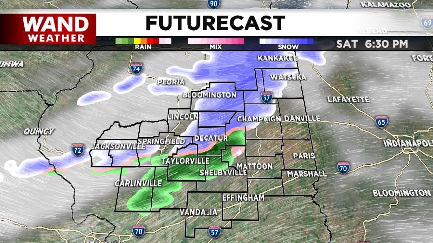

Mixed showers are headed our way this evening. In our northern communities, these should be all snow, and it will be a heavy, wet snow. In our central and southern spots where temperatures are a bit higher, this will likely start as a cold rain before transitioning to snow. These showers will move northwest toward southeast across our communities from 6 to 10 PM.

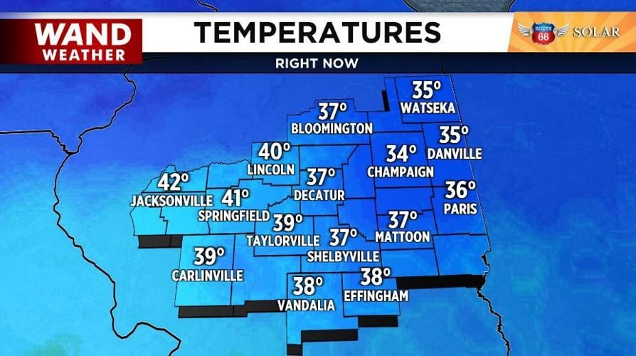
Temperatures will be dropping from the upper 30s/lower 40s down toward freezing as this moisture moves through. A northwest breeze will add more cold air to the atmosphere, too, helping drop temperatures efficienty.

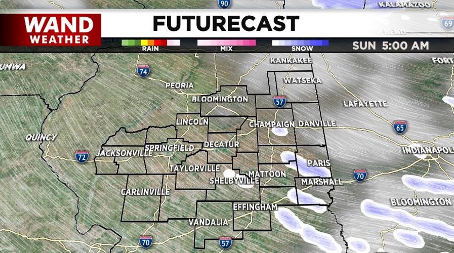
A few flurries may be left by daybreak Sunday, but most of the snow should be gone by then.

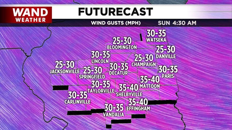
Wind gusts through this time period will likely top out around 35 mph. While that is not strong enough to do damage, it is enough to blow the falling snow around. That blowing snow could lead to visibility issues, so be extra cautious if you plan to be out on the roads tonight.

Copyright 2026. WANDTV. All Rights Reserved.


