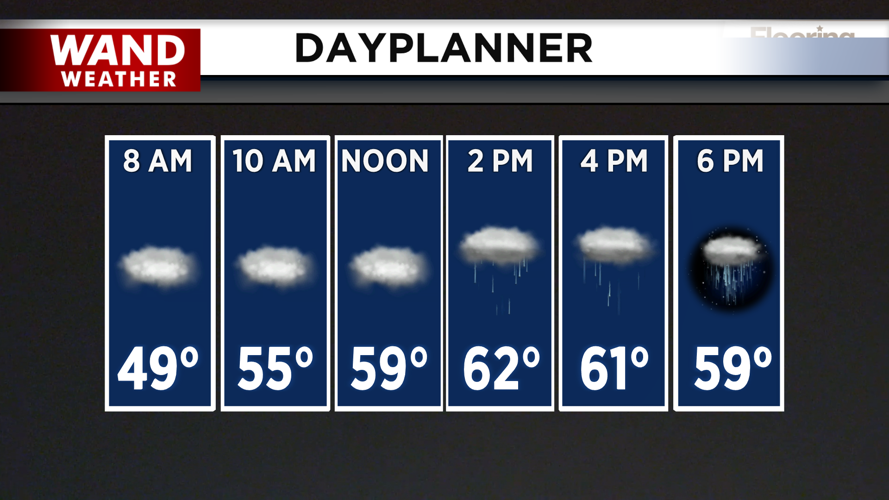
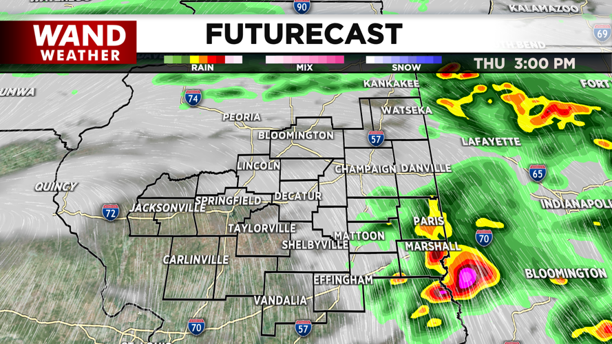
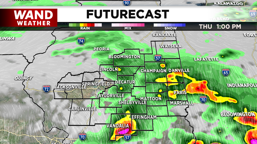
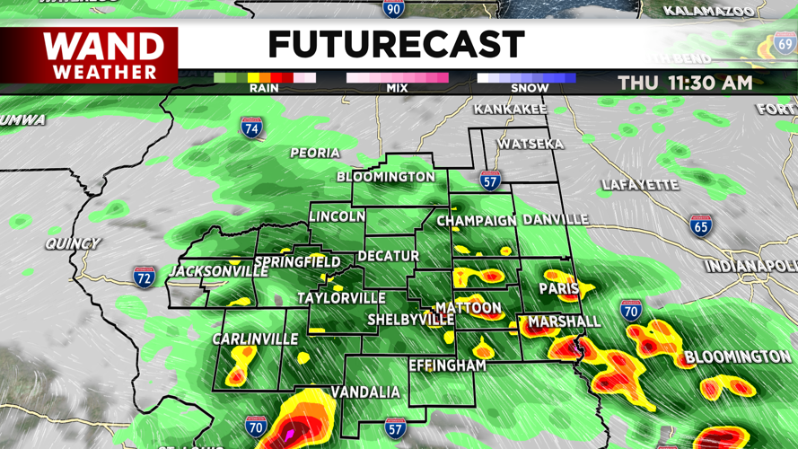
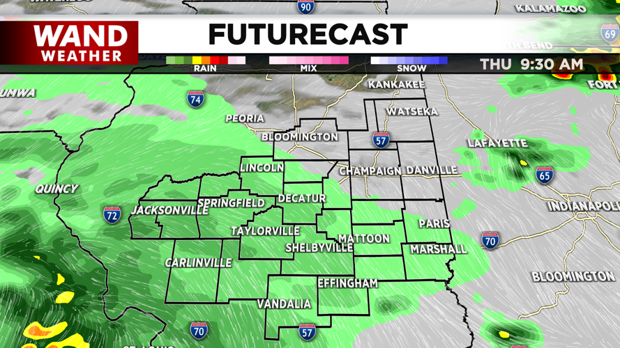


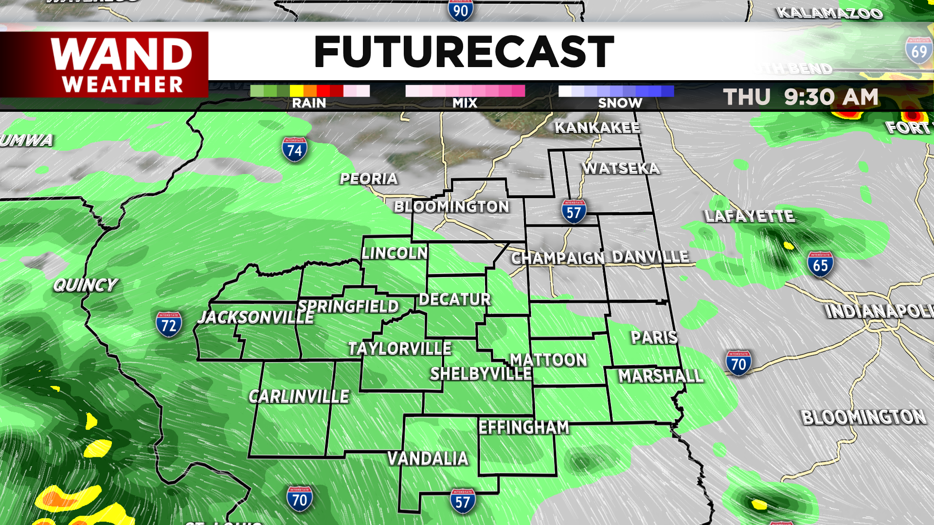
DECATUR, IL. (WAND) - A severe weather threat is possible this afternoon as a cold front approaches Central Illinois. Temperatures will soar into the 60s ahead of this system and help fuel these storms. Scattered showers are expected to move in this morning around 9. Strong thunderstorms will develop closer to 11 am or noon. Thunderstorms will linger through the early evening before things calm down closer to 7 or 8 tonight.


While all modes of severe weather will be possible, the main threats with these storms will be strong wind gusts of 60 mph. Isolated tornadoes could also emerge through the evening. Be weather aware, and download the WAND Weather app to your phone to get alerts in your area.
It will be very windy tonight behind the storms as a low-pressure system moves through just off to our north. Expect wind gusts of 40 to 45 mph through the overnight hours and early Friday morning. Winds will ease throughout the day as the system moves eastward. Skies will also clear late Friday, but this will lead to a significant drop in temperatures for the weekend.
Copyright 2026. WANDTV. All Rights Reserved.


