

DECATUR, IL. (WAND) - A warm start to the week brings hazy skies and health concerns on Monday, followed by a severe weather threat after midnight and a return to comfortable conditions by midweek.
Monday: Smoke and Heat
Wildfire smoke from Canada will blanket central Illinois on Monday, creating hazy conditions and reducing air quality throughout the day. An Air Quality Alert is in effect, so sensitive groups should limit outdoor activities.
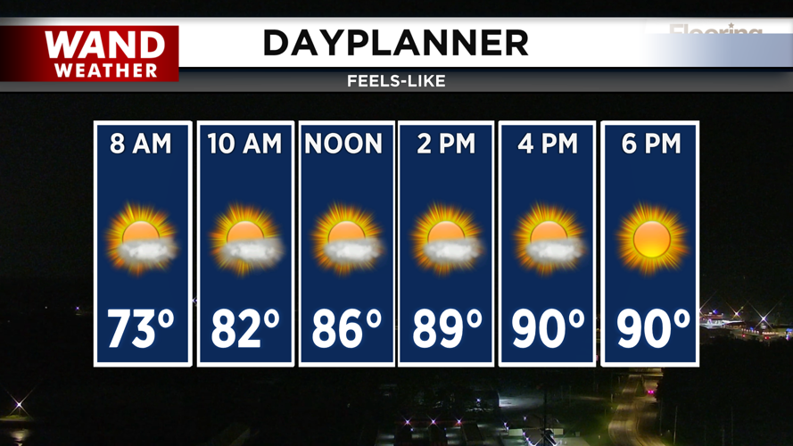
The good news? Southerly winds will push the smoke plume northeastward by evening, bringing noticeable relief by nightfall. Expect hot, humid conditions, with feels-like temperatures reaching the low 90s.
Monday Night Into Tuesday: Severe Storm Threat
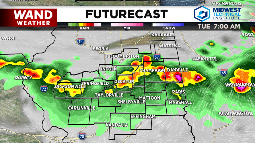
An organized line of severe storms is expected to move through central Illinois after midnight Monday into early Tuesday morning. Moderate confidence exists for a severe weather threat, with the primary danger being damaging downburst winds.
Stay weather-aware Monday night and have a way to receive warnings. The WAND Weather team will be monitoring this system closely and updating you throughout the evening.
Tuesday: Lingering Storms in Southeast, Warming Afternoon
A slowing cold front will keep a lower confidence threat of storms in southeast Illinois through Tuesday afternoon. Elsewhere, temperatures will quickly warm into the upper 80s by afternoon as northwest winds take over, bringing lower humidity.
Wednesday and Beyond: Finally Comfortable
A sprawling Canadian high-pressure system settles into the Midwest beginning Wednesday, ushering in a drier air mass and relief from recent heat. Expect comfortable temperatures topping out in the low to mid-80s, with a dry forecast through the remainder of the workweek.
Copyright 2026. WANDTV. All Rights Reserved.


