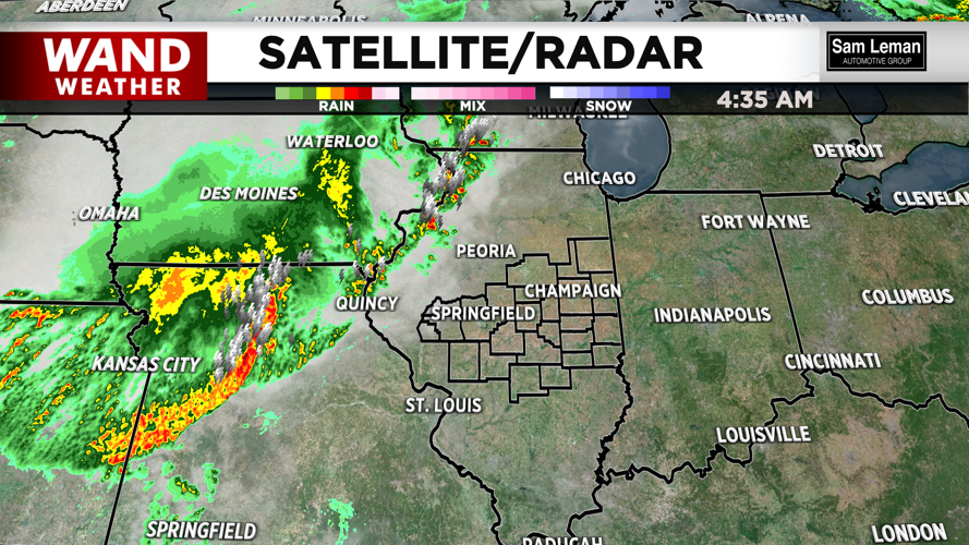
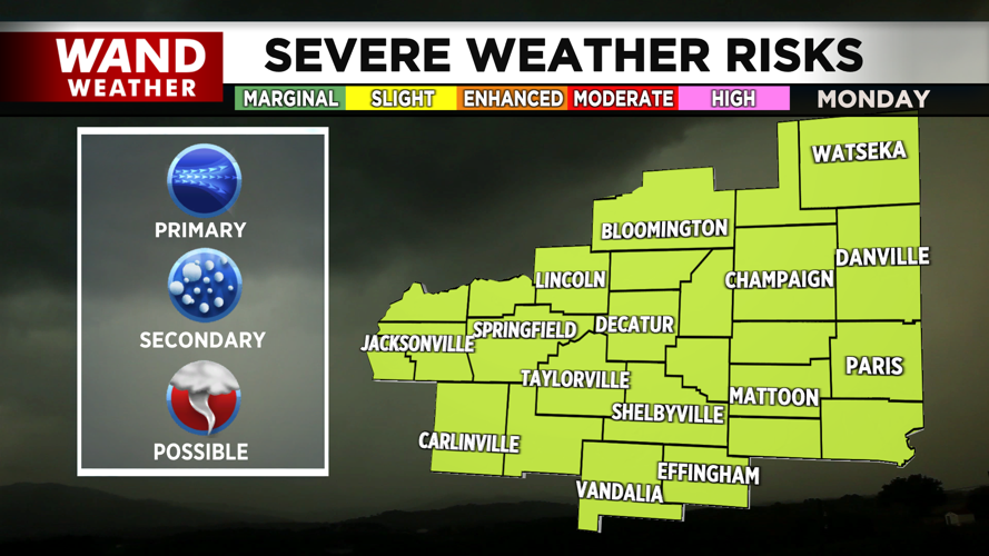
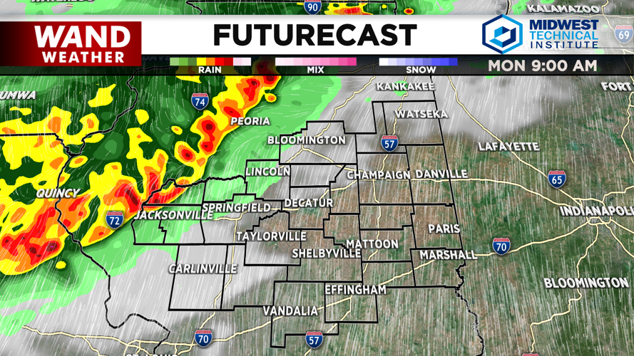
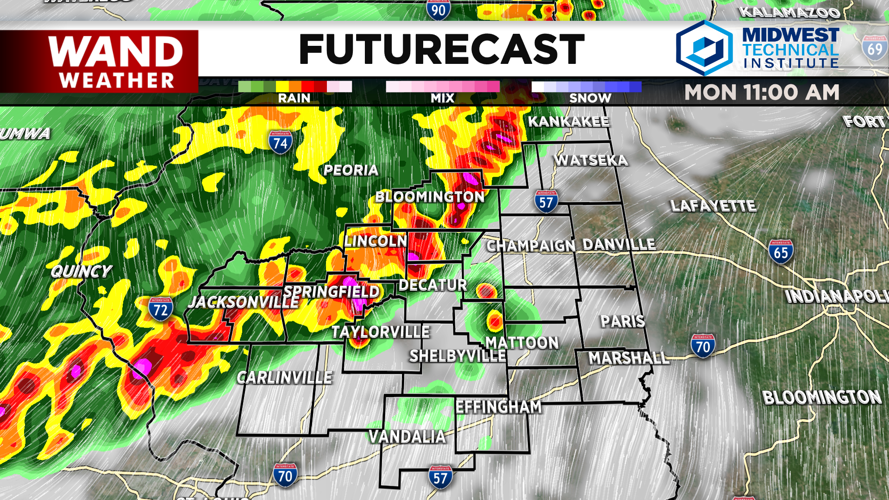
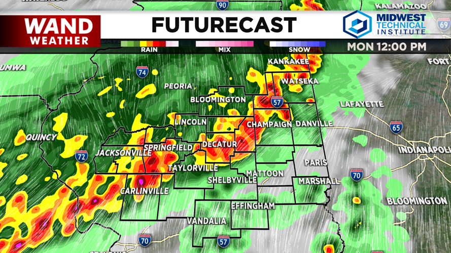
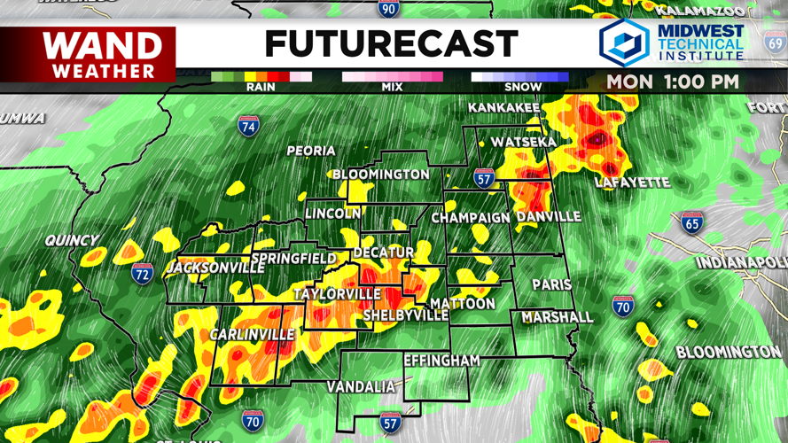
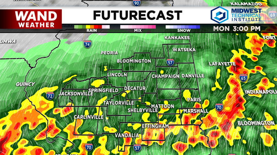


DECATUR, IL. (WAND) - Strong to severe thunderstorms will roll through Central Illinois this morning. These storms will pack strong winds, heavy rain, and some lightning. Hail will be possible with these storms. This organized line of storms will move from west to east throughout the morning and early afternoon. Be weather aware today.
Things should clear out by the evening, but temperatures will stay hot and muggy through the evening. Overnight lows will drop into the upper 60s ahead of our next system. A cold front will push through Central Illinois on Tuesday. This will trigger another round of storms for early Tuesday morning. Some of these could also be strong to severe. Storms should clear out by the afternoon.
Wednesday will be much calmer and cooler. Temperatures will start in the 50s and warm into the upper 60s with a mix of sun and clouds. Thursday is looking very comfortable with mostly sunny skies and highs in the low 70s. Rain chances will return on Friday, but no severe weather is expected with the rain. Temperatures will warm into the low 80s for the weekend.
Copyright 2026. WANDTV. All Rights Reserved.


