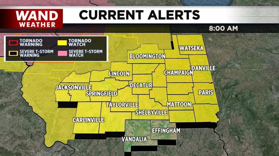

DECATUR, Ill. (WAND) - The National Weather Service issued a Tornado Watch for portions of Central Illinois on Wednesday.

Counties in yellow are under a Tornado Watch on Wednesday, June 17, 2026, until 3 p.m. CDT.
The watch was issued as the first of two rounds of storms moved into Central Illinois. The watch includes most of the WAND viewing area and is in effect until 3 p.m.
WATCH | The latest WAND weather forecast
A stronger, more severe line of storms is expected late Wednesday afternoon into the evening hours. There are threats of strong tornadoes, damaging winds and hail, and flash flooding.
BOOKMARK the WAND Weather radar

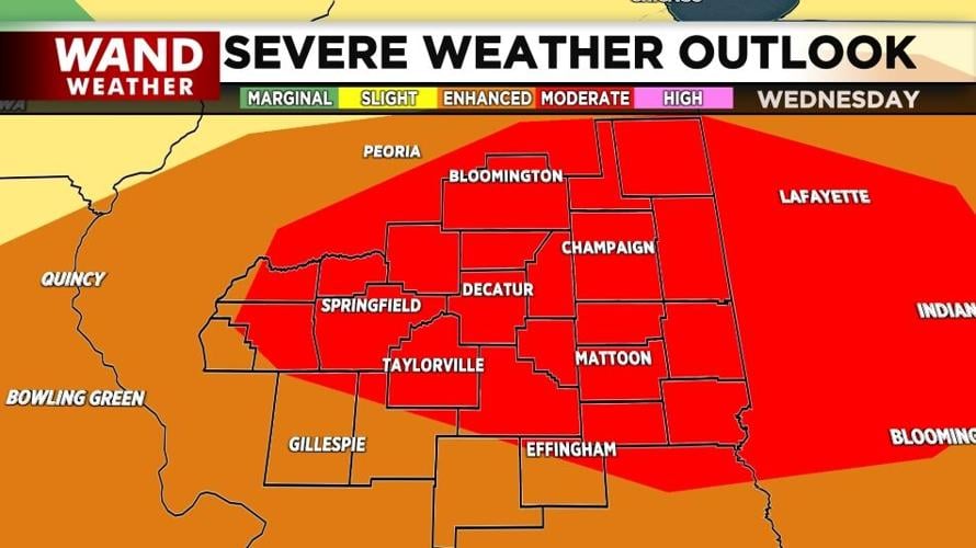
The red shaded area is under a Moderate Risk for severe weather while the orange shaded area is under an Enhanced Risk for severe weather on Wednesday, June 17, 2026, according to the National Weather Service. (WAND Weather)
The WAND Weather Team expects temperatures to climb in the afternoon after the first round of storms, which will ripen the atmosphere for more severe weather. Wind gusts could hit 75 miles per hour or higher in these storms. Power outages are likely.
Stay up-to-date with regular video forecasts, weather alerts, and a live radar in your neighborhood with the WAND Weather app. It's available for download in your phone's app store.
Copyright 2026. WANDTV. All Rights Reserved.


