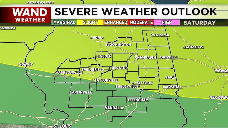

The Storm Prediction Center has included most of our area in a Slight risk (level 2 out of 5) of severe storms Saturday. The strongest storms look like they will arrive in the middle of the day, but there will be a few different rounds of storms during the day.

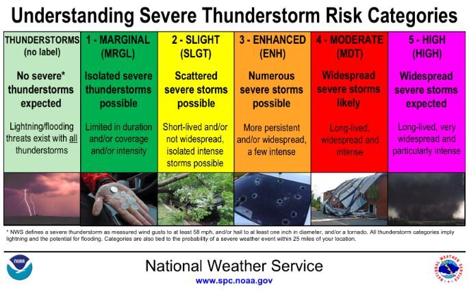
It is unlikely our risk level from the SPC will be upgraded. A Slight risk means "scattered severe storms (are) possible" where storms are "short-lived and/or not widespread, isolated intense storms (are) possible." The next category up (level 3 of 5) calls for "numerous severe storms" which are "more persistent and/or widespread, a few intense."
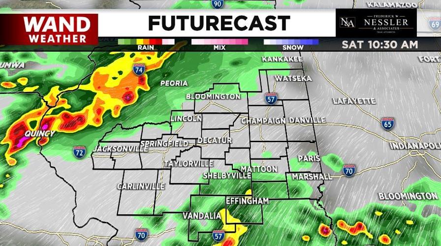
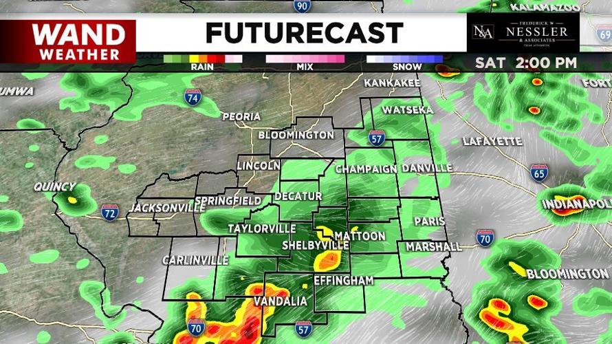
As we discuss timing of these storms, please keep in mind that each round of storms will affect the one after it. The exact timing and placement of each wave will alter the timing and placement of the next round, so you will want to check in with us through the weekend to get the most updated forecast.

Between 10 AM and 4 PM a line of strong storms will move through our communities. Wind gusts strong enough to do damage are the main threat; those can get up to 60 mph. Heavy rain, thunder and lightning will also be part of these storms, so we will keep an eye on the flash flood potential.

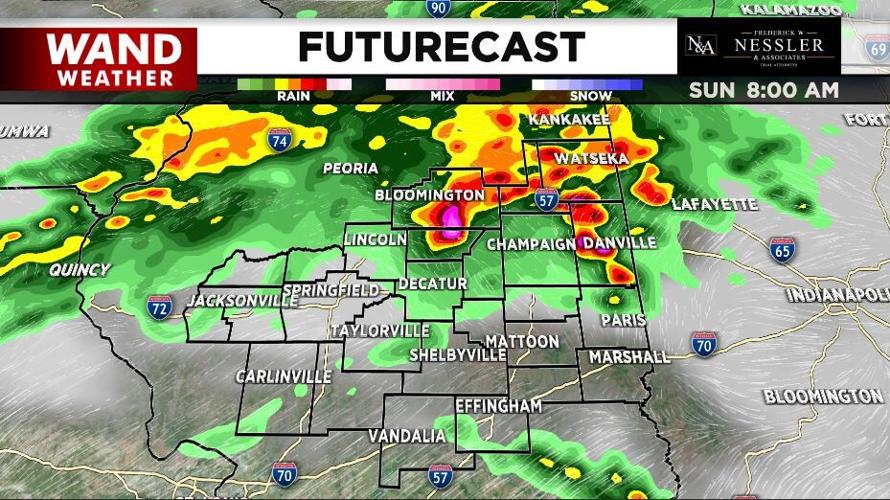
Sunday morning will also bring a round of strong thunderstorms, but their timing, placement, and intensity will depend on what happens Saturday afternoon.


