

(WAND) - The record warmth from Monday is a thing of the past.
A strong cold front that moved through Central Illinois last evening brought gusty winds and falling temperatures.
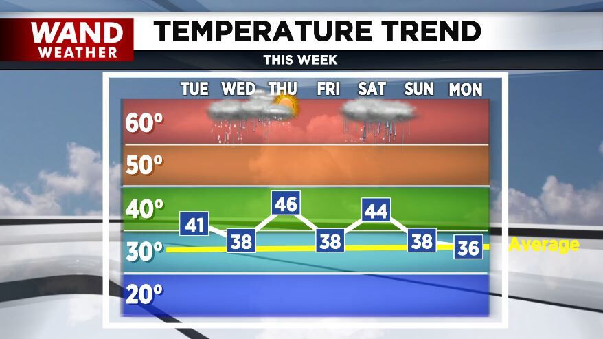
Highs today under a sun and cloud mix will be around 40° and we'll drop into the 20s tonight.
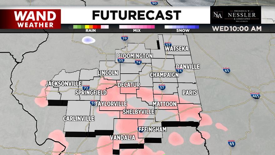
Warmer air pushing northward Wednesday morning could bring a period of freezing rain to Central Illinois and it only takes a light glaze to make roadways slick.
By afternoon, it should be warm enough for all rain for many of us except maybe across the far north.
Rain is likely Wednesday night with a few rumbles of thunder possible.
Temperatures drop during the day Thursday as the rain moves out.
Another wintry mix is possible Friday night and early Saturday before it changes over to rain during the day.
Meteorologist Anthony Peoples
Copyright 2025 WAND TV. All rights reserved.