DECATUR, Ill. (WAND) - Additional heavy rain is on the way to Central Illinois along with the threat of severe storms.
One to three inches of rain fell across parts of the area Thursday and Thursday night with the strong storms that prompted warnings and a possible tornado in Sangamon County.
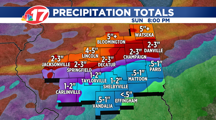
Periods of heavy rain are in the forecast today through the weekend. Additional rainfall amounts will range from an inch or so south to as much as five inches across the north.

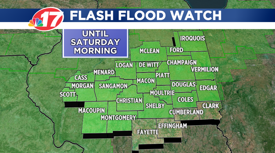
A "Flash Flood Watch" remains in effect for much of Central Illinois through Saturday morning.

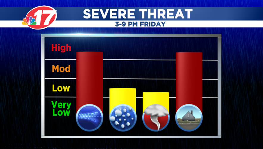
Along with the flooding threat from the heavy downpours, another round of severe weather is possible Friday afternoon and evening. Damaging winds will be the biggest threat, but additional tornadoes are possible.

As we head into the weekend, more rain will fall and there could be additional strong to severe storms.
The weather pattern doesn't change much into the middle of next week.
To see the current WAND Radar, click here.