


(WAND WEATHER)- Central Illinois is under a severe weather threat this afternoon.
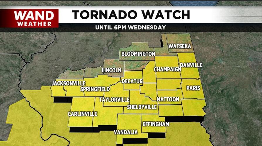
A "Tornado Watch" is in effect through 6 p.m. Wednesday for much of Central Illinois.
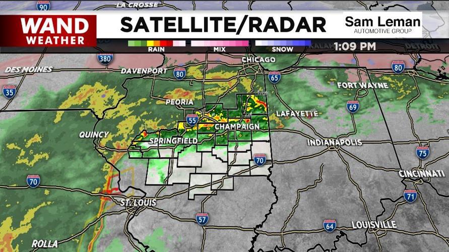
Severe storms across eastern Missouri will quickly race through the area and be to our east by this evening.
Damaging winds are the biggest threat with these storms, but a few isolated tornadoes are possible.
Heavy rain is also likely with some hometowns across the north picking up 2" or more.
The National Weather Service has issued a tornado watch 41 in effect until 6 p.m. CTS this evening for the following areas in Illinois.
This watch includes 21 counties in central Illinois: Christian, Macon, Sangamon, Shelby, in east central Illinois, Champaign, Clark, Coles, Cumberland, Douglas, Edgar, Moultrie, Piatt, Vermilion, in Southeast Illinois, Clay, Crawford, Effingham, Jasper , Lawrence, Richland, in west central Illinois, Morgan, Scott, this includes the cities of Champaign, Charelston, Danville, Decatur, Effingham, Flora, Greenup, Jacksonville, Lawrenceville, Marshall, Mattoon, Monticello, Newton, Olney, Paris, Robinson, Shelbyville, Springfield, Sullivan, Taylorville, Tuscola, Urbana, and Winchester.


