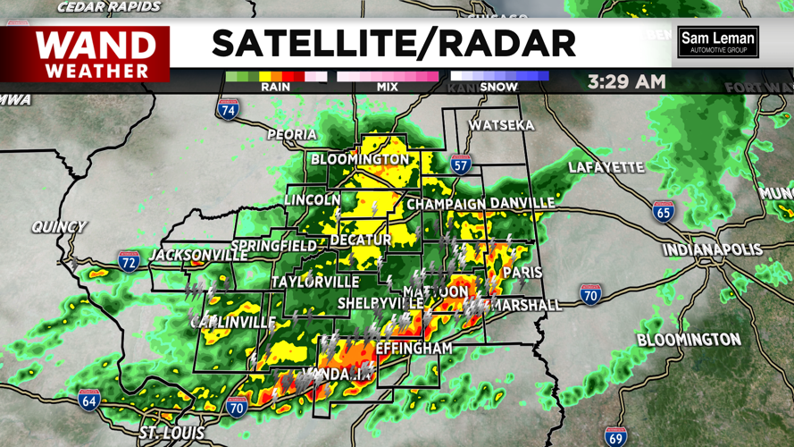


DECATUR, IL. (WAND) - It was a very active Wednesday night with several tornado warnings issued. Damage reports are still coming in, but there was widespread wind damage across much of the area. Thunderstorms are just beginning to exit the area now, but we are not out of the woods when it comes to severe weather risks for the rest of the week.
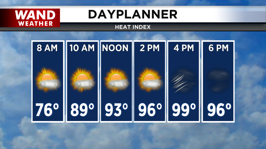
Temperatures have cooled off slightly with the rain and are sitting in the upper 60s to start the day. Temperatures will warm up quickly with a mix of sun and clouds through the morning. High temperatures will again push into the upper 80s and low 90s this afternoon. The heat index will be over 100 degrees with gusty winds out of the southwest.
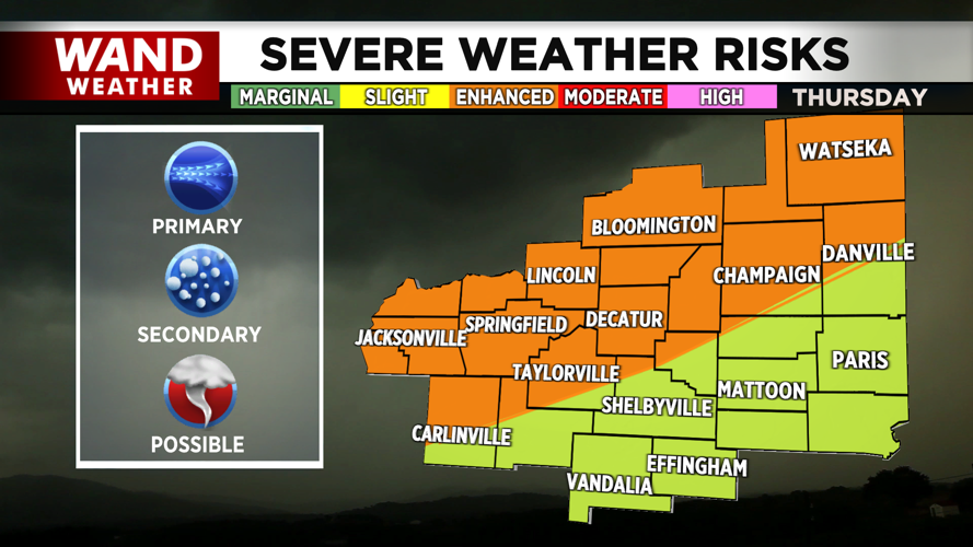
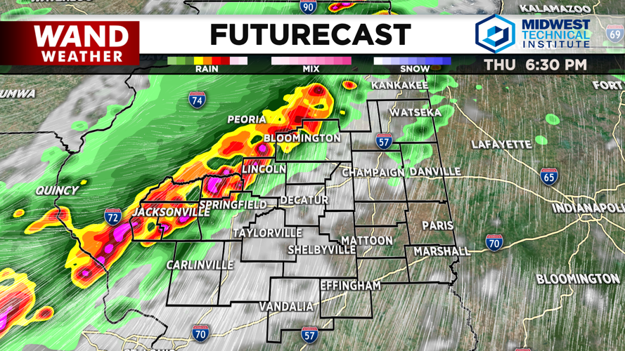
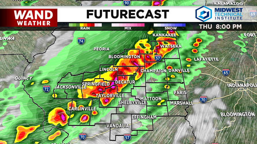
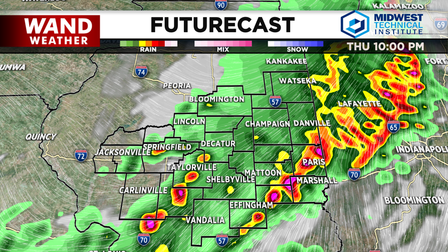
Another round of severe thunderstorms is expected on Thursday evening. Look for a line of storms to form around 6 this evening and move southward across Central Illinois over four hours. The main threat with these storms will be straight-line winds in excess of 70 mph. Tornadic development will be possible in this line of storms as well. The storms will exit around 10 pm.
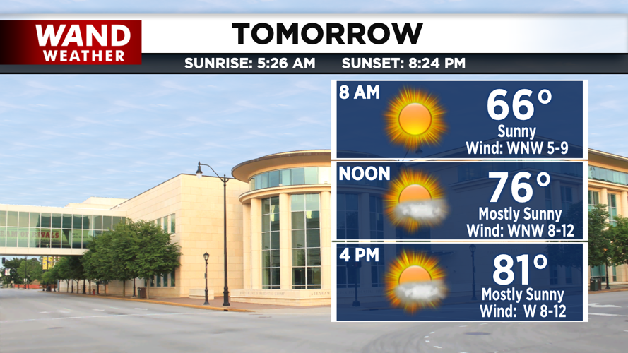
Winds will shift from south to north as a cold front moves across Illinois. Much cooler temperatures will take over behind the front. High temperatures will be seasonable in the low 80s for Friday afternoon with sunshine returning. Humidity will be much lower on Friday, before there is a slight uptick in it on Saturday. Cooler temperatures return for next week with highs staying in the 70s.
Copyright 2026. WANDTV. All Rights Reserved.


