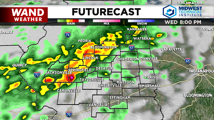


DECATUR, IL. (WAND) - Central Illinois is heading into a hot and active stretch of weather, with widespread showers and thunderstorms expected to move across the region this afternoon and evening, bringing the potential for severe weather and dangerous flooding.
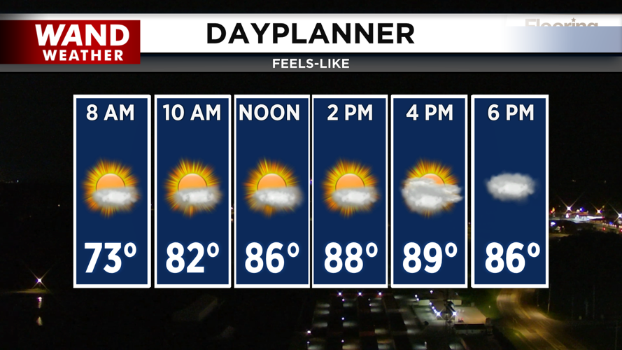
Temperatures will warm quickly on Wednesday with southwest winds pushing actual highs into the upper 80s. However, humidity will make it feel more like the low 90s, so plan for a hot, muggy day before storms arrive.
Storm Threat This Afternoon and Tonight
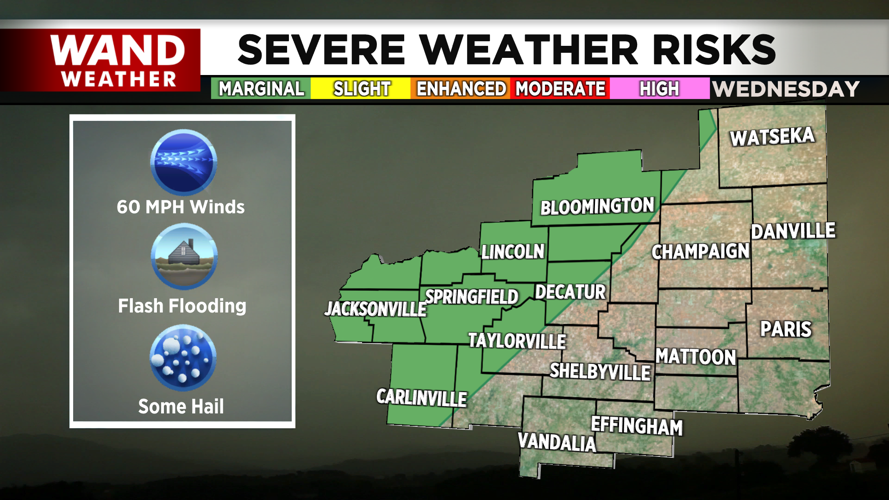
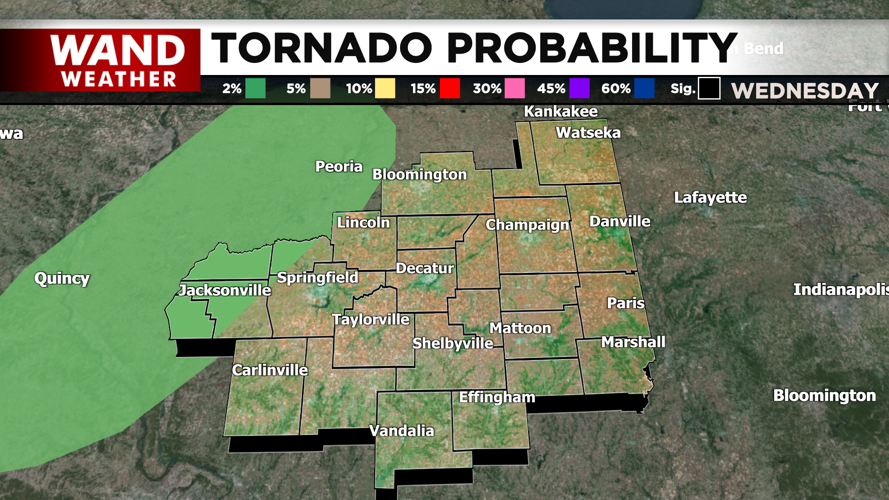
Widespread showers and thunderstorms will develop this afternoon and evening across central Illinois. A marginal risk for severe weather exists west of a Taylorville to Gibson City line, with the primary threat being damaging winds. A 2% tornado risk is possible west of I-55, though this remains a low probability.
The more significant concern is heavy rain. Flash flooding could develop as storms move through the region this afternoon, evening, and into early Thursday morning. Residents should monitor conditions closely and avoid driving through flooded roadways.
Cooler Thursday, More Storms Possible Friday
The cold front bringing Wednesday's storms will stall over central Illinois, keeping the region unsettled through Friday. Thursday will be cooler with lingering showers and storms possible, with highs only reaching the low 80s. Friday will be close to normal with highs in the mid-80s, but additional showers and storms could develop in the afternoon and evening before clearing out by Saturday afternoon.
Heat Returns This Weekend
After Saturday clears with mid-80s highs, hot and humid conditions will return Sunday through Tuesday. Heat index values could approach 100 degrees as humidity builds back into the region. However, passing thunderstorm clusters may periodically develop and provide temporary relief from the intense heat.
Copyright 2026. WANDTV. All Rights Reserved.


