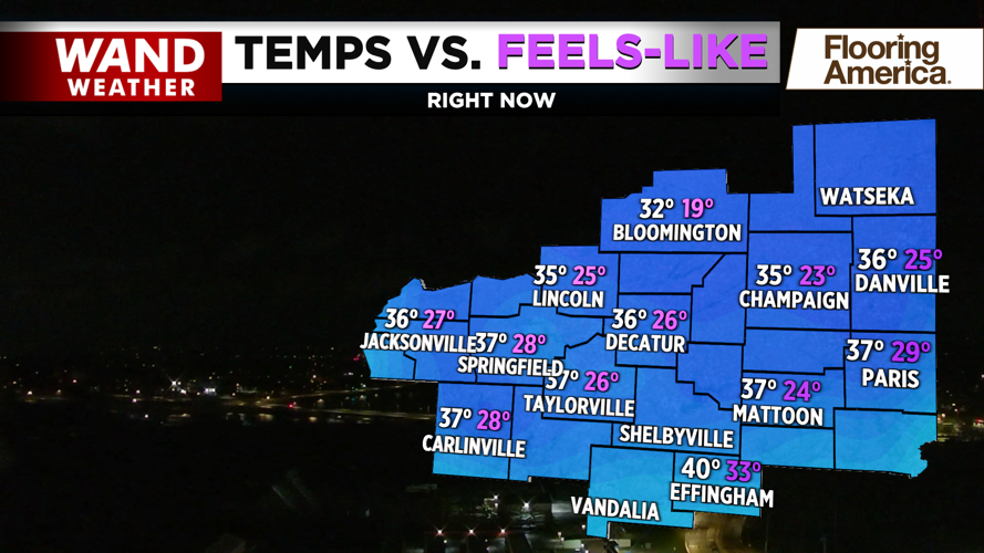
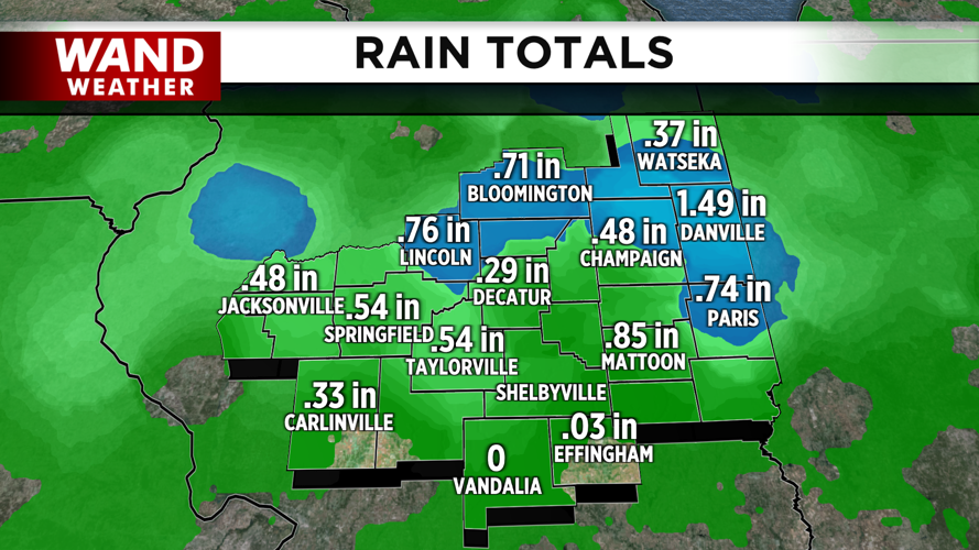
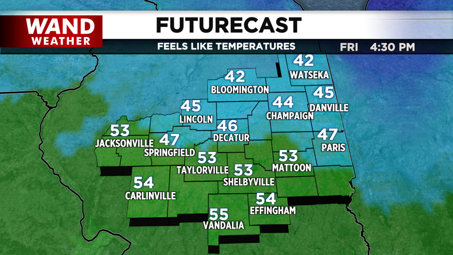


DECATUR, IL. (WAND) - Happy Friday! The severe thunderstorms have moved on, but steady showers are hanging around for the I-70 corridor. The cold air has arrived behind the storms as temperatures have dropped into the 30s overnight. Gusty winds out of the north will hang around through the morning with mostly cloudy skies. This will keep temperatures low through the morning. High temperatures will be 40 degrees cooler than yesterday as sunny skies take over for the afternoon.
Temperatures will drop quickly overnight tonight with mostly clear skies. Overnight lows will drop below freezing in the upper 20s. This will be the coldest morning on the 7-day forecast. Temperatures will warm up into the low 50s with plenty of sunshine on Saturday afternoon.
The warming trend will continue for next week. Highs will hit the low 60s by Sunday afternoon. Temperatures could climb back into the upper 70s and low 80s by the middle of next week. The next system will impact Illinois by Wednesday afternoon. This could bring in another round of heavy rain and storms.
Have a fantastic weekend!
Copyright 2026. WANDTV. All Rights Reserved.


