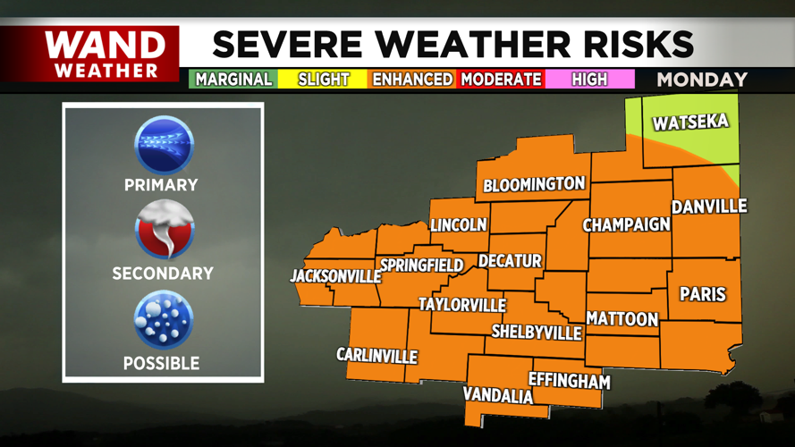


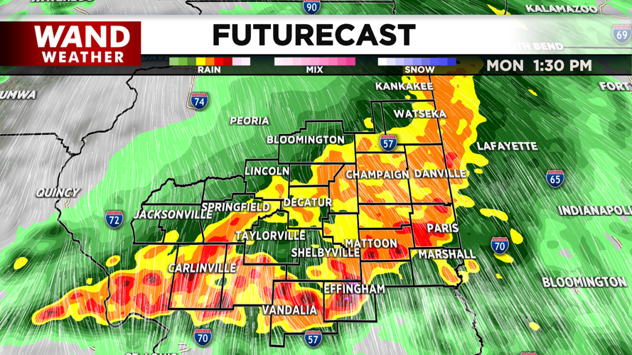
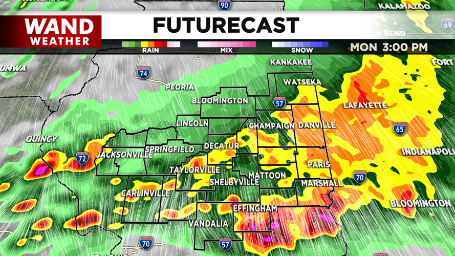
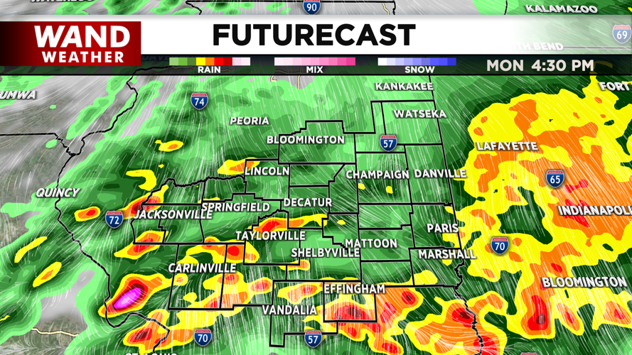
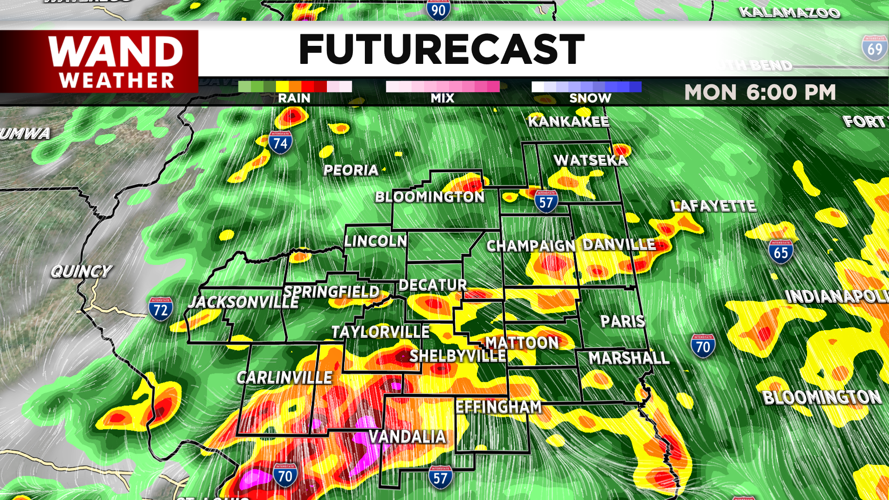
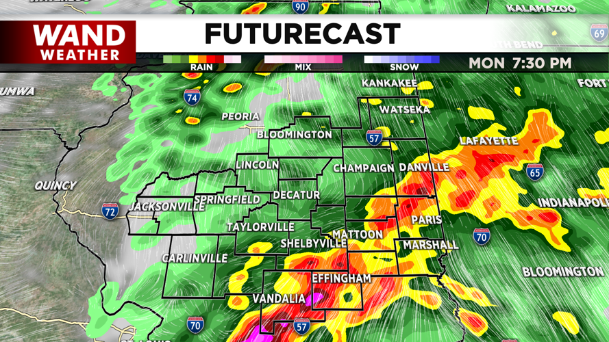


DECATUR, IL. (WAND) - The severe weather threat for Monday will be widespread this afternoon. All modes of severe weather will be possible.
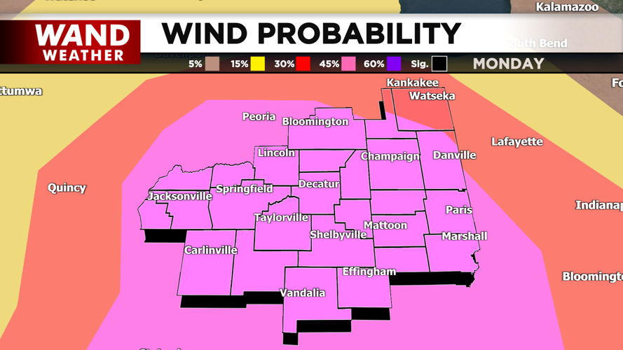
Strong wind gusts with the storms will be the most widespread threat. We could have gusts of 70 mph as these storms roll through the area.
Tornadoes and large hail are also possible as these storms move through Central Illinois.
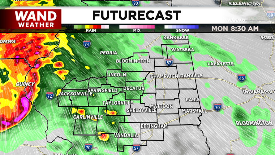
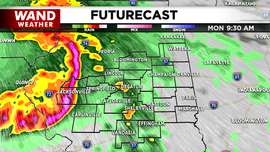
Some early morning storms have developed ahead of the main line of storms this morning. These storms will move through Illinois in the early morning and could use up some energy in the atmosphere.
There are two scenarios that we are tracking for later today.
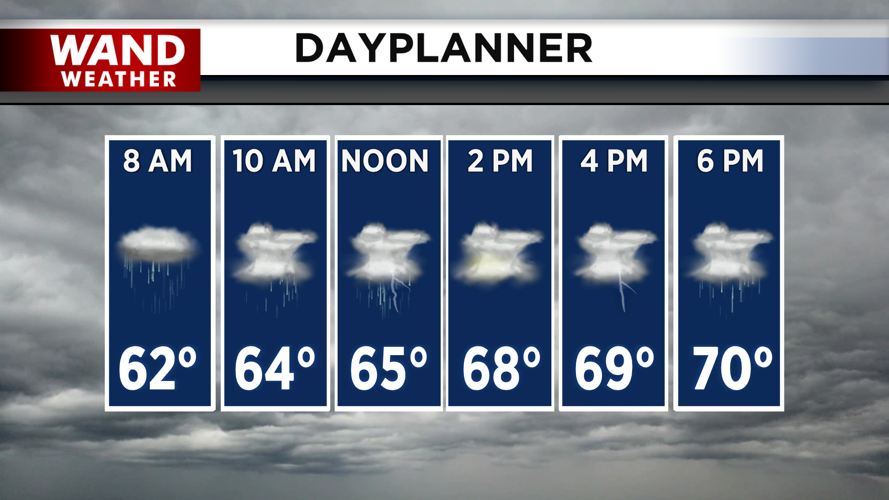
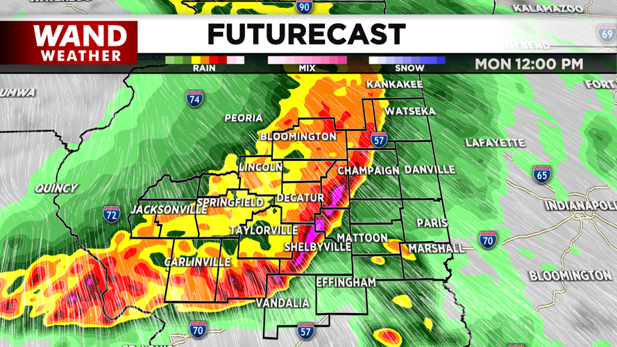
Scenario one is more likely: strong storms will develop across Central Illinois around 11 am. These will be strong to severe and produce heavy rain and wind gusts. The latest models are showing thunderstorms lingering in Central Illinois through the afternoon. This would keep temperatures lower in the upper 60s and low 70s. This would also keep the afternoon severe weather risk a bit lower. While strong storms would still be likely, the severe threat would be lower.
Scenario two still has storms moving through this morning, but those storms could weaken by the middle of the day. This would lead to a lull in thunderstorm activity for the early afternoon hours from 2 to 4. This would allow temperatures to climb back up into the upper 70s. This would also result in much higher chances for storms to hit severe weather limits this evening.
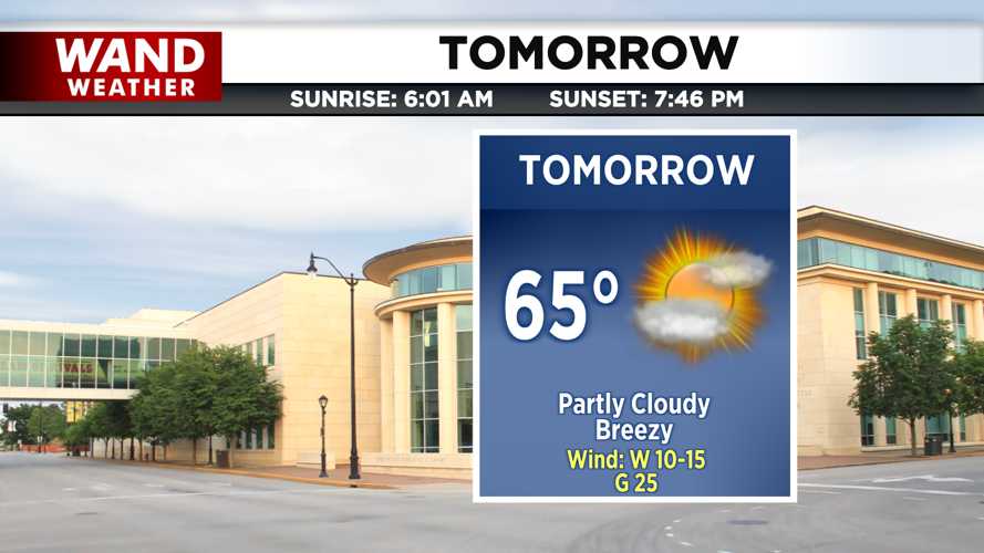
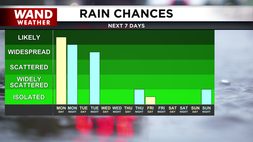
All storms will be moving very quickly today, so download the WAND Weather app to get the latest alerts. Storms will exit before midnight tonight, and much calmer weather is anticipated for the rest of the week. Some rain chances will move in overnight Tuesday, but no thunderstorms are expected with that rain.
Have a safe week!
Copyright 2026. WANDTV. All Rights Reserved.


