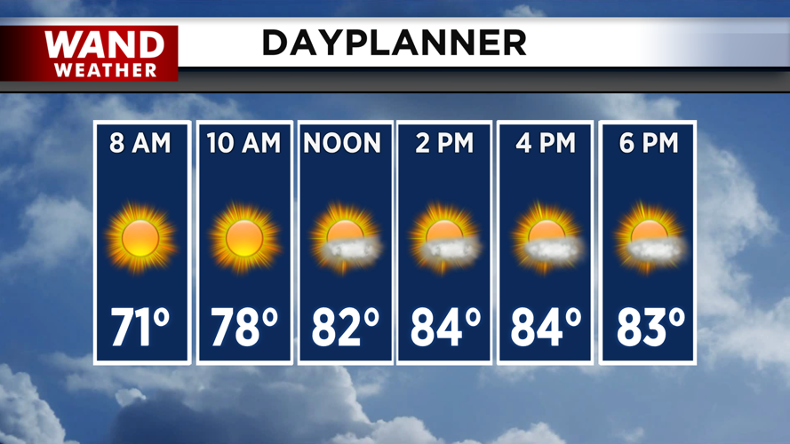


DECATUR, IL. (WAND) - Enjoy the nice weather while it lasts. A high-pressure system will keep Central Illinois pleasant Tuesday with a mix of sun and clouds and highs in the mid-80s. While humidity won't be a major concern, it will feel closer to the upper 80s during the afternoon. Overnight, temperatures will drop into the mid-60s with mostly clear skies as we head into Wednesday morning.
But Wednesday brings a significant shift in the weather pattern. An approaching cold front will push into the Midwest, triggering multiple rounds of showers and storms throughout the day and into Thursday.
Severe Weather Threat Wednesday Afternoon and Evening
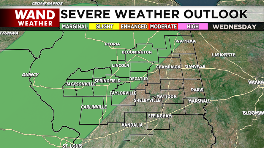
The Storm Prediction Center has issued a marginal risk (level 1 of 5) for severe weather west and northwest of a St. Louis to Watseka line on Wednesday. While a few showers and storms may develop Wednesday morning, these are expected to fall apart as they move eastward, keeping the early-day severe threat low.
The main window for severe weather will be mid-afternoon into the early evening Wednesday. All hazards are possible, but damaging wind gusts are the primary concern. The severe threat should diminish overnight as the daytime heating effect ends.
The Weather Prediction Center has also issued a slight risk for excessive rainfall over nearly the same area, and forecast models are hinting at training storms — where storms repeatedly move over the same areas — from Wednesday into Thursday. This combination could lead to flash flooding in some locations, so stay alert for updates.
Unsettled Pattern Continues Thursday, Possible Storms Friday
The cold front will stall out over Illinois, producing several rounds of showers and storms on Thursday. Temperatures will be cooler with the storm activity, with highs staying in the low 80s.
Friday looks mostly dry during the day with a mix of sun and clouds, but storm chances could return for the afternoon and evening. Highs will remain mild in the mid-80s.
Heat Returns for the Weekend
After the unsettled midweek pattern, hotter conditions are expected to return for the weekend and into next week.
Copyright 2026. WANDTV. All Rights Reserved.


